California Historical Landmarks in Amador County
Map all coordinates using OpenStreetMap
Download coordinates as:
- KML
- GPX (all coordinates)
- GPX (primary coordinates)
- GPX (secondary coordinates)
This list includes properties and districts listed on the California Historical Landmark listing in Amador County, California. Click the "Map of all coordinates" link to the right to view a Google map of all properties and districts with latitude and longitude coordinates in the table below.
| Image | [1] | Landmark name | Location | City or town | Summary |
|---|---|---|---|---|---|
 | 786 | Argonaut Mine | 38°21′53″N 120°47′14″W / 38.364717°N 120.7871°W / 38.364717; -120.7871 (Argonaut Mine) | Jackson | Shares an entry with Kennedy Mine |
 Upload Photo | 41 | Big Bar | Big Bar Rd. & Highway 49 38°18′43″N 120°43′12″W / 38.31186°N 120.71993°W / 38.31186; -120.71993 (Big Bar) | Jackson | |
 | 39 | Butte Store | State Highway 49 at milepost 1.4 38°19′32″N 120°44′07″W / 38.325533°N 120.735217°W / 38.325533; -120.735217 (Butte Store) | Jackson | |
Upload Photo | 1001 | Chaw'se Roundhouse | 14881 Pine Grove/Volcano Rd. 38°25′27″N 120°38′36″W / 38.424167°N 120.643333°W / 38.424167; -120.643333 (Chaw'se Roundhouse) | Pine Grove | |
Upload Photo | 37 | Clinton | Historic district 38°22′34″N 120°40′06″W / 38.376111°N 120.668333°W / 38.376111; -120.668333 (Clinton) | Clinton | |
 | 506 | Community Methodist Church of Ione | 150 W. Marlette 38°21′00″N 120°55′58″W / 38.35°N 120.932778°W / 38.35; -120.932778 (Community Methodist Church of Ione) | Ione | Also on the NRHP list as NPS-77000287 |
Upload Photo | 762 | D'Agostini Winery | 14430 Shenandoah Rd. 38°31′59″N 120°45′18″W / 38.533°N 120.755°W / 38.533; -120.755 (D'Agostini Winery) | Plymouth | |
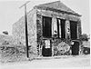
 | 788 | D. Stewart Co. Store | 18 E. Main St. 38°21′10″N 120°55′59″W / 38.352828°N 120.933001°W / 38.352828; -120.933001 (D. Stewart Co. Store) | Ione | |
 | 31 | Drytown | Historic district 38°26′28″N 120°51′16″W / 38.441111°N 120.854444°W / 38.441111; -120.854444 (Drytown) | Drytown | |
Upload Photo | 38 | Irishtown | Historic district 38°23′20″N 120°40′29″W / 38.388889°N 120.674722°W / 38.388889; -120.674722 (Irishtown) | Pine Grove | |
 | 118 | Jackson Gate | Big Bar Rd. & Highway 49 38°22′05″N 120°46′32″W / 38.367964°N 120.775486°W / 38.367964; -120.775486 (Jackson Gate) | Jackson | |
 | 786 | Kennedy Mine | 38°21′53″N 120°47′14″W / 38.364717°N 120.7871°W / 38.364717; -120.7871 (Kennedy Mine) | Jackson | Shares an entry with Argonaut Mine. Also on the NRHP list as NPS-81000146 |
Upload Photo | 40 | Kirkwood's | Hwy 88 & Carson Pass 38°42′10″N 120°04′21″W / 38.702683°N 120.072417°W / 38.702683; -120.072417 (Kirkwood's) | Kirkwood | |
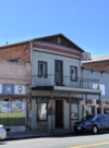
 | 1007 | Knight Foundry | 81 Eureka St. 38°23′36″N 120°47′01″W / 38.393333°N 120.783611°W / 38.393333; -120.783611 (Knight Foundry) | Sutter Creek | Also on the NRHP list as NPS-75000423 |
Upload Photo | 30 | Lancha Plana | North shore of Camanche Reservoir 38°13′29″N 120°54′07″W / 38.224722°N 120.901944°W / 38.224722; -120.901944 (Lancha Plana) | Buena Vista | |
Upload Photo | 28 | Maiden's Grave | Carson Pass 38°37′54″N 120°10′16″W / 38.6318°N 120.171233°W / 38.6318; -120.171233 (Maiden's Grave) | Kirkwood | |
Upload Photo | 36 | Middle Bar | Middle Bar Rd at Mokelumne River 38°17′55″N 120°45′01″W / 38.2984972222222°N 120.750252777778°W / 38.2984972222222; -120.750252777778 (Middle Bar) | Jackson | |
 | 662 | Old Emigrant Road | State Highway 88 at Mud Lake Rd. 38°38′15″N 120°08′32″W / 38.637386°N 120.142214°W / 38.637386; -120.142214 (Old Emigrant Road) | Kirkwood | |
 | 35 | Oleta (Old Fiddletown) | Historic district 38°30′14″N 120°45′20″W / 38.503889°N 120.755556°W / 38.503889; -120.755556 (Oleta (Old Fiddletown)) | Fiddletown | |
Upload Photo | 34 | Pioneer Hall | 113 Main St. 38°20′57″N 120°46′27″W / 38.349067°N 120.774283°W / 38.349067; -120.774283 (Pioneer Hall) | Jackson | |
Upload Photo | 470 | Plymouth Trading Post | On Main St., between Mill & Mineral Sts. 38°28′52″N 120°50′51″W / 38.481133°N 120.847549°W / 38.481133; -120.847549 (Plymouth Trading Post) | Plymouth | Later Plymouth Consolidated Mine office |
 | 867 | Preston Castle | On Main St., between Mill & Mineral Sts. 38°21′40″N 120°56′09″W / 38.361111°N 120.935833°W / 38.361111; -120.935833 (Preston Castle) | Ione | Also on the NRHP list as NPS-75000422 |
Upload Photo | 715 | Site of the first amateur astronomical observatory of record in California | Consolation & Main St. 38°26′34″N 120°37′53″W / 38.4428°N 120.631333°W / 38.4428; -120.631333 (Site of the first amateur astronomical observatory of record in California) | Volcano | |
Upload Photo | 865 | Site of Jackson's Pioneer Jewish Synagogue | Church & Main Sts. 38°21′04″N 120°46′24″W / 38.351067°N 120.773317°W / 38.351067; -120.773317 (Site of Jackson's Pioneer Jewish Synagogue) | Jackson | Marker is at Jackson Grammar School |
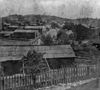
 | 322 | Sutter Creek | Historic district 38°23′35″N 120°48′09″W / 38.393056°N 120.8025°W / 38.393056; -120.8025 (Sutter Creek) | Sutter Creek | |
 | 29 | Volcano | Intersection of Main and Consolation Sts. 38°26′35″N 120°37′51″W / 38.443056°N 120.630833°W / 38.443056; -120.630833 (Volcano) | Volcano |
References
- ^ "California Historical Landmarks By County". Ohp.parks.ca.gov. Retrieved 2019-04-03.
See also
- National Register of Historic Places listings in Amador County, California
- List of California Historical Landmarks
Wikimedia Commons has media related to California Historical Landmarks in Amador County, California.
- v
- t
- e
Municipalities and communities of Amador County, California, United States
County seat: Jackson

communities
‡This CDP also has portions in an adjacent county or counties
- California portal
- United States portal


