Grade II* listed buildings in Bath and North East Somerset

Bath and North East Somerset (commonly referred to as BANES or B&NES) is a unitary authority created on 1 April 1996, following the abolition of the County of Avon, which had existed since 1974.[1] Part of the ceremonial county of Somerset, Bath and North East Somerset occupies an area of 220 square miles (570 km2), two-thirds of which is green belt.[2] It stretches from the outskirts of Bristol, south into the Mendip Hills and east to the southern Cotswold Hills and Wiltshire border.[2] The city of Bath is the principal settlement in the district, but BANES also covers Keynsham, Midsomer Norton, Radstock and the Chew Valley. The area has a population of 170,000, about half of whom live in Bath, making it 12 times more densely populated than the rest of the area.[2]
In the United Kingdom, the term listed building refers to a building or other structure officially designated as being of special architectural, historical, or cultural significance; Grade II* structures are those considered to be "particularly significant buildings of more than local interest".[3] Listing was begun by a provision in the Town and Country Planning Act 1947. Once listed, strict limitations are imposed on the modifications allowed to a building's structure or fittings. In England, the authority for listing under the Planning (Listed Buildings and Conservation Areas) Act 1990[4] rests with Historic England, a non-departmental public body sponsored by the Department for Digital, Culture, Media and Sport; local authorities have a responsibility to regulate and enforce the planning regulations.
Bath and North East Somerset has 212 Grade II* listed buildings.
Map all coordinates using OpenStreetMap
Download coordinates as:
- KML
- GPX (all coordinates)
- GPX (primary coordinates)
- GPX (secondary coordinates)
Buildings
Bath
| Name | Location | Type | Completed [note 1] | Grid ref.[note 2] Geo-coordinates | Entry number [note 3] | Image | Ref. |
|---|---|---|---|---|---|---|---|
| 18 and 19 and attached Railings, New King Street | New King Street | Terraced House | 1764-1770 | ST7455964891 51°22′57″N 2°22′01″W / 51.382491°N 2.366956°W / 51.382491; -2.366956 (18 and 19 and attached Railings, New King Street) | 1396262 |  More images | |
| Abbey Cemetery Partis Tomb | Ralph Allen Drive | Tomb | 1846 | ST7587763645 51°22′17″N 2°20′53″W / 51.371346°N 2.347933°W / 51.371346; -2.347933 (Abbey Cemetery Partis Tomb) | 1396338 |  Upload Photo | |
| Abbey Cemetery Williams Tomb | Ralph Allen Drive | Tomb | 1848 | ST7582363611 51°22′16″N 2°20′55″W / 51.371038°N 2.348706°W / 51.371038; -2.348706 (Abbey Cemetery Williams Tomb) | 1396355 | Upload Photo | |
| Bath District Register Office | Charlotte Street | Register Office | After 1916 | ST7463265010 51°23′01″N 2°21′57″W / 51.383565°N 2.365916°W / 51.383565; -2.365916 (Bath District Register Office) | 1395566 | Upload Photo | |
| Bath Spa Station | Manvers Street | Railway Station | c. 1840 | ST7524564350 51°22′40″N 2°21′25″W / 51.377657°N 2.357061°W / 51.377657; -2.357061 (Bath Spa Station) | 1395629 |  More images | |
| Bathwick Grange | Bathwick Hill | Detached House | 1829 | ST7651164407 51°22′42″N 2°20′20″W / 51.378224°N 2.338876°W / 51.378224; -2.338876 (Bathwick Grange) | 1394226 | Upload Photo | |
| Bathwick Hill House | Bathwick Hill | Villa | Circa 1825 | ST7658564411 51°22′42″N 2°20′16″W / 51.378263°N 2.337813°W / 51.378263; -2.337813 (Bathwick Hill House) | 1394230 |  More images | |
| Bathwick Lodge | Bathwick Hill | Villa | 1825 | ST7598764770 51°22′53″N 2°20′47″W / 51.381466°N 2.346429°W / 51.381466; -2.346429 (Bathwick Lodge) | 1394183 | Upload Photo | |
| Beau Nash's House, with Railings | St John's Place | Detached House | c. 1720 | ST7486264854 51°22′56″N 2°21′45″W / 51.382172°N 2.3626°W / 51.382172; -2.3626 (Beau Nash's House, with Railings) | 1394862 |  More images | |
| Bloomfield Crescent Nos. 1-7 (consec.) including Gate Piers | Bloomfield Road | Terrace | Circa 1793-1795 | ST7385962902 51°21′52″N 2°22′37″W / 51.364575°N 2.376867°W / 51.364575; -2.376867 (Bloomfield Crescent Nos. 1-7 (consec.) including Gate Piers) | 1394793 | Upload Photo | |
| Bridge in Sydney Gardens | Sydney Gardens | Footbridge | 1800 | ST7587065366 51°23′13″N 2°20′53″W / 51.38682°N 2.348151°W / 51.38682; -2.348151 (Bridge in Sydney Gardens) | 1395952 |  More images | |
| Bridge over railway | Sydney Road | Road Bridge | c. 1840 | ST7579765199 51°23′07″N 2°20′57″W / 51.385315°N 2.349188°W / 51.385315; -2.349188 (Bridge over railway) | 1395307 |  More images | |
| Bridge over railway in Sydney Gardens | Sydney Gardens | Bridge | C1840 | ST7581465331 51°23′11″N 2°20′56″W / 51.386503°N 2.348953°W / 51.386503; -2.348953 (Bridge over railway in Sydney Gardens) | 1395281 |  More images | |
| Casa Bianca and La Casetta | Bathwick Hill | Villa | Circa 1846 | ST7639164512 51°22′45″N 2°20′26″W / 51.379163°N 2.340607°W / 51.379163; -2.340607 (Casa Bianca and La Casetta) | 1394246 | Upload Photo | |
| Chandos House | Westgate Buildings | House | 1726-30 | ST7489864681 51°22′50″N 2°21′43″W / 51.380618°N 2.36207°W / 51.380618; -2.36207 (Chandos House) | 1395635 | Upload Photo | |
| Christian Centre (formerly The Forum Cinema) | St James's Parade | Cinema | 1960-66 | ST7499964461 51°22′43″N 2°21′38″W / 51.378645°N 2.360603°W / 51.378645; -2.360603 (Christian Centre (formerly The Forum Cinema)) | 1394832 |  More images | |
| Church of Our Lady and St Alphege, with attached Presbytery | Oldfield Lane | Church | 1929 | ST7390163886 51°22′24″N 2°22′35″W / 51.373425°N 2.376337°W / 51.373425; -2.376337 (Church of Our Lady and St Alphege, with attached Presbytery) | 1396234 |  More images | |
| Church of St Mary | Bathwick Hill | Gate Pier | 19th century | ST7567965088 51°23′04″N 2°21′03″W / 51.384312°N 2.350876°W / 51.384312; -2.350876 (Church of St Mary) | 1394251 |  More images | |
| Church of St Michael | Broad Street | Church | 1835-1837 | ST7505865017 51°23′01″N 2°21′35″W / 51.383647°N 2.359795°W / 51.383647; -2.359795 (Church of St Michael) | 1395025 |  More images | |
| Church of St Michael and All Angels | How Hill | Parish Church | 15th century | ST7239364721 51°22′51″N 2°23′53″W / 51.380861°N 2.398066°W / 51.380861; -2.398066 (Church of St Michael and All Angels) | 1395896 |  More images | |
| Church of St Saviour | St Saviour's Road | Church | 1829-1832 | ST7599366350 51°23′44″N 2°20′47″W / 51.395673°N 2.34645°W / 51.395673; -2.34645 (Church of St Saviour) | 1394886 |  More images | |
| Church of St Stephen | Lansdown Road | Parish Hall | 1993-94 | ST7480066043 51°23′34″N 2°21′49″W / 51.39286°N 2.363575°W / 51.39286; -2.363575 (Church of St Stephen) | 1394265 |  More images | |
| Church of St Swithin | The Paragon | Parish Church | 1779-1790 | ST7509265562 51°23′19″N 2°21′34″W / 51.388548°N 2.359345°W / 51.388548; -2.359345 (Church of St Swithin) | 1394245 |  More images | |
| Church of St Thomas à Becket | Widcombe | Church | C20 | ST 75972 63877 | 1394116 |  More images | |
| Cleveland Baths | Hampton Row | Swimming pool | 1815 | ST7593265821 51°23′27″N 2°20′50″W / 51.390914°N 2.347291°W / 51.390914; -2.347291 (Cleveland Baths) | 1396146 |  More images | |
| Cleveland Bridge and four former Toll Houses | Cleveland Place | Bridge | 1827 | ST7533765655 51°23′22″N 2°21′21″W / 51.389395°N 2.35583°W / 51.389395; -2.35583 (Cleveland Bridge and four former Toll Houses) | 1394634 |  More images | |
| Cleveland House | Sydney Road | House | Converted 1864 | ST7588665221 51°23′08″N 2°20′52″W / 51.385517°N 2.347911°W / 51.385517; -2.347911 (Cleveland House) | 1395310 |  More images | |
| Compass Abbey Hotel (Part) | No 2, North Parade | House | 1740 | ST7519164677 51°22′50″N 2°21′28″W / 51.380595°N 2.35786°W / 51.380595; -2.35786 (Compass Abbey Hotel (Part)) | 1395777 |  More images | |
| Compass Abbey Hotel (Part) | No 3, North Parade | House | 1740 | ST7519164677 51°22′50″N 2°21′28″W / 51.380595°N 2.35786°W / 51.380595; -2.35786 (Compass Abbey Hotel (Part)) | 1395779 | Upload Photo | |
| Countess of Huntingdon's Chapel including Chapel House | The Paragon | Church House | 1765 | ST7501365367 51°23′12″N 2°21′38″W / 51.386792°N 2.360466°W / 51.386792; -2.360466 (Countess of Huntingdon's Chapel including Chapel House) | 1395527 |  More images | |
| Cumberland House | 1-7, Norfolk Crescent | Crescent | Circa 1810 | ST7438464938 51°22′58″N 2°22′10″W / 51.382906°N 2.369474°W / 51.382906; -2.369474 (Cumberland House) | 1395744 |  | |
| Doric House and attached Wall | Cavendish Road | House | 1803 | ST7432265978 51°23′32″N 2°22′14″W / 51.392254°N 2.37044°W / 51.392254; -2.37044 (Doric House and attached Wall) | 1395469 |  | |
| East Gate | Boat Stall Lane | Town Gate | Possibly C9-C10 | ST7517564871 51°22′56″N 2°21′29″W / 51.382339°N 2.358103°W / 51.382339; -2.358103 (East Gate) | 1394942 | 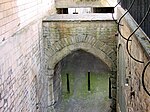 | |
| Elim Pentecostal Church | Charlotte Street | Nonconformist Chapel | 1854 | ST7463764983 51°23′00″N 2°21′57″W / 51.383322°N 2.365842°W / 51.383322; -2.365842 (Elim Pentecostal Church) | 1395580 | 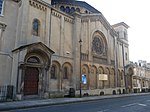 More images | |
| Elton House | Abbey Street | House | 1699 | ST7509664680 51°22′50″N 2°21′33″W / 51.380618°N 2.359225°W / 51.380618; -2.359225 (Elton House) | 1394064 | Upload Photo | |
| Eyre Chantry (Roman Catholic Chapel), Perrymead Cemetery | Pope's Walk | Chantry Chapel | by 1863 | ST7582663459 51°22′11″N 2°20′55″W / 51.369671°N 2.348653°W / 51.369671; -2.348653 (Eyre Chantry (Roman Catholic Chapel), Perrymead Cemetery) | 1406474 | Upload Photo | |
| Fiesole (Youth Hostel) | Bathwick Hill | Villa | 1846-1848 | ST7640164588 51°22′47″N 2°20′26″W / 51.379847°N 2.340468°W / 51.379847; -2.340468 (Fiesole (Youth Hostel)) | 1394259 |  More images | |
| Footbridge over Canal in Sydney Gardens | Sydney Gardens | Footbridge | 1800 | ST7587265314 51°23′11″N 2°20′53″W / 51.386352°N 2.348118°W / 51.386352; -2.348118 (Footbridge over Canal in Sydney Gardens) | 1395961 |  More images | |
| Forecourt Wall, Gatepiers, Gates and Overthrows to Countess of Huntingdon's Chapel | Vineyards | Gate | c. 1765 | ST7503765371 51°23′13″N 2°21′36″W / 51.386829°N 2.360122°W / 51.386829; -2.360122 (Forecourt Wall, Gatepiers, Gates and Overthrows to Countess of Huntingdon's Chapel) | 1395528 | | |
| General Joseph Smith Tomb in Church of All Saints Churchyard | Weston | Chest Tomb | C1790 | ST7310566368 51°23′45″N 2°23′17″W / 51.395704°N 2.387961°W / 51.395704; -2.387961 (General Joseph Smith Tomb in Church of All Saints Churchyard) | 1396358 | Upload Photo | |
| Gothic Temple in Grounds of Rainbow Wood | Widcombe Hill | Summerhouse | 1745 | ST7661163743 51°22′20″N 2°20′15″W / 51.372258°N 2.337395°W / 51.372258; -2.337395 (Gothic Temple in Grounds of Rainbow Wood) | 1395766 | Upload Photo | |
| High Pavement and Railings fronting Nos 1 to 10 | Portland Place | Raised Pavement | 1786 | ST7473565640 51°23′21″N 2°21′52″W / 51.389234°N 2.364481°W / 51.389234; -2.364481 (High Pavement and Railings fronting Nos 1 to 10) | 1394404 | 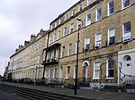 | |
| Jupiter Statue in the Botanical Gardens | The Dell, Royal Victoria Park | Bust | 1835-8 | ST7391465584 51°23′19″N 2°22′35″W / 51.388693°N 2.376275°W / 51.388693; -2.376275 (Jupiter Statue in the Botanical Gardens) | 1394743 |  More images | |
| Kennet and Avon Canal Tunnel (under Beckford Road) | Beckford Road | Canal Tunnel | c. 1800 | ST7588565453 51°23′15″N 2°20′53″W / 51.387603°N 2.347941°W / 51.387603; -2.347941 (Kennet and Avon Canal Tunnel (under Beckford Road)) | 1395965 |  More images | |
| Kennet and Avon Canal Tunnel (under Cleveland House and Sydney Road) | Sydney Road | Canal Tunnel | C1800 | ST7588665240 51°23′08″N 2°20′52″W / 51.385688°N 2.347912°W / 51.385688; -2.347912 (Kennet and Avon Canal Tunnel (under Cleveland House and Sydney Road)) | 1395966 |  More images | |
| King Edward's School | Broad Street | Teachers House | 1752 | ST7500465084 51°23′03″N 2°21′38″W / 51.384247°N 2.360575°W / 51.384247; -2.360575 (King Edward's School) | 1395027 |  More images | |
| Kirkness House and attached Piers, Railings and Lamp Standards | Edward Street | Apartment | 2010 | ST7558765075 51°23′03″N 2°21′08″W / 51.384191°N 2.352197°W / 51.384191; -2.352197 (Kirkness House and attached Piers, Railings and Lamp Standards) | 1395428 | Upload Photo | |
| Lansdown Cemetery, Entrance Gates, Piers and Walls | Lansdown Road | Gate Lodge | 1848 | ST7380567553 51°24′23″N 2°22′41″W / 51.406392°N 2.377988°W / 51.406392; -2.377988 (Lansdown Cemetery, Entrance Gates, Piers and Walls) | 1394446 |  More images | |
| Linley House | Pierrepont Place | House | C1730 | ST7521764645 51°22′49″N 2°21′27″W / 51.380309°N 2.357484°W / 51.380309; -2.357484 (Linley House) | 1394377 | Upload Photo | |
| Lodge Style | Shaft Road | Detached House | 1909 | ST7673262632 51°21′44″N 2°20′08″W / 51.362273°N 2.335584°W / 51.362273; -2.335584 (Lodge Style) | 1394909 | Upload Photo | |
| Lyncombe House | Lyncombe Vale Road | Detached House | 1742 | ST7532563461 51°22′11″N 2°21′21″W / 51.369667°N 2.35585°W / 51.369667; -2.35585 (Lyncombe House) | 1395279 | Upload Photo | |
| Manor House | Royal United Hospital | Manor House | Medieval | ST7292166176 51°23′38″N 2°23′26″W / 51.393969°N 2.390591°W / 51.393969; -2.390591 (Manor House) | 1395661 |  More images | |
| Monument to Sir Bevil Grenville at National Grid Reference ST7219 7034 | Charlcombe | Commemorative Monument | 1720 | ST7218970345 51°25′53″N 2°24′05″W / 51.431419°N 2.40144°W / 51.431419; -2.40144 (Monument to Sir Bevil Grenville at National Grid Reference ST7219 7034) | 1214434 |  More images | |
| Mortuary Chapel in Abbey Cemetery | Ralph Allen Drive | Cemetery Chapel | 1844 | ST7587263561 51°22′14″N 2°20′53″W / 51.37059°N 2.347999°W / 51.37059; -2.347999 (Mortuary Chapel in Abbey Cemetery) | 1394604 |  More images | |
| Museum Shop, formerly Concert Room | Abbey Church Yard | Museum | 2010 | ST7507464739 51°22′52″N 2°21′34″W / 51.381148°N 2.359545°W / 51.381148; -2.359545 (Museum Shop, formerly Concert Room) | 1394020 | Upload Photo | |
| New Bridge or Newton Bridge | Newbridge | Bridge | 1727 | ST7167965783 51°23′25″N 2°24′30″W / 51.390375°N 2.40841°W / 51.390375; -2.40841 (New Bridge or Newton Bridge) | 1395726 |  More images | |
| No. 14 and attached Railings, Crane and Overthrow | Alfred Street | House | 1773-1775 | ST7486165253 51°23′09″N 2°21′46″W / 51.38576°N 2.362642°W / 51.38576; -2.362642 (No. 14 and attached Railings, Crane and Overthrow) | 1394140 |  More images | |
| No. 1A including a Flight of Steps below to the Right and 3 Bollards | The Paragon | Steps | Pre-1776 | ST7504365275 51°23′09″N 2°21′36″W / 51.385966°N 2.360029°W / 51.385966; -2.360029 (No. 1A including a Flight of Steps below to the Right and 3 Bollards) | 1394240 | Upload Photo | |
| No. 20 and attached Garden Walls, Balustrade and Gate Piers | Vineyards | Apartment | 1973-1976 | ST7502765444 51°23′15″N 2°21′37″W / 51.387484°N 2.36027°W / 51.387484; -2.36027 (No. 20 and attached Garden Walls, Balustrade and Gate Piers) | 1395523 | Upload Photo | |
| Nos. 1 and 2 and attached Steps and Railings | Upper Camden Place | Terraced House | 1815 | ST7501065857 51°23′28″N 2°21′38″W / 51.391197°N 2.360544°W / 51.391197; -2.360544 (Nos. 1 and 2 and attached Steps and Railings) | 1395461 | Upload Photo | |
| Nos. 14 and 15 The Grapes (No. 14) | Westgate Street | House | 17th century Fabric | ST7492364753 51°22′53″N 2°21′42″W / 51.381267°N 2.361716°W / 51.381267; -2.361716 (Nos. 14 and 15 The Grapes (No. 14)) | 1395641 | Upload Photo | |
| Nos. 1-7 (consec.) with Railings | Northumberland Buildings | Terrace | 1778 | ST7487264960 51°22′59″N 2°21′45″W / 51.383126°N 2.362463°W / 51.383126; -2.362463 (Nos. 1-7 (consec.) with Railings) | 1396192 | Upload Photo | |
| Nos. 6-26 (Even) Ralph Allen Cottages, and Priory Cottage (No. 26) | Prior Park Road | Terrace | 1728-40 | ST7551464172 51°22′34″N 2°21′11″W / 51.376069°N 2.353184°W / 51.376069; -2.353184 (Nos. 6-26 (Even) Ralph Allen Cottages, and Priory Cottage (No. 26)) | 1394481 |  More images | |
| Oakwood and Bathwick Tower | Bathwick Hill | Villa | Circa 1814 | ST7680964315 51°22′39″N 2°20′05″W / 51.377409°N 2.334588°W / 51.377409; -2.334588 (Oakwood and Bathwick Tower) | 1394280 | Upload Photo | |
| Obelisk | Orange Grove | Obelisk | 1734 | ST7518464797 51°22′54″N 2°21′29″W / 51.381674°N 2.357969°W / 51.381674; -2.357969 (Obelisk) | 1394210 |  More images | |
| Obelisk | Queen Square | Obelisk | 1738 | ST7479464993 51°23′00″N 2°21′49″W / 51.383419°N 2.363587°W / 51.383419; -2.363587 (Obelisk) | 1394569 |  More images | |
| Octagon Chapel (Royal Photographic Society) | Milsom Street | Photographic Gallery | 1983 | ST7499465011 51°23′01″N 2°21′39″W / 51.38359°N 2.360714°W / 51.38359; -2.360714 (Octagon Chapel (Royal Photographic Society)) | 1396027 |  More images | |
| Old Royal Baths | Hot Bath Street | Thermal Baths | 1775-1778 | ST7496664667 51°22′50″N 2°21′40″W / 51.380495°N 2.361092°W / 51.380495; -2.361092 (Old Royal Baths) | 1395891 |  More images | |
| Rear-Admiral Philip Affleck Tomb in Church of All Saints Churchyard | Weston | Tomb | C1799 | ST7313166358 51°23′44″N 2°23′15″W / 51.395616°N 2.387586°W / 51.395616; -2.387586 (Rear-Admiral Philip Affleck Tomb in Church of All Saints Churchyard) | 1396362 | Upload Photo | |
| Retaining Wall and Balustrade West of Railway Line | Sydney Gardens | Balustrade | C1840 | ST7582565392 51°23′13″N 2°20′56″W / 51.387052°N 2.348799°W / 51.387052; -2.348799 (Retaining Wall and Balustrade West of Railway Line) | 1395289 |  More images | |
| Retaining Wall East of Railway Line | Sydney Gardens | Revetment | C1840 | ST7583665394 51°23′13″N 2°20′55″W / 51.38707°N 2.348641°W / 51.38707; -2.348641 (Retaining Wall East of Railway Line) | 1395287 |  More images | |
| Roman Catholic Church of St John | South Parade | Roman Catholic Church | 1861-63 | ST7535264587 51°22′47″N 2°21′20″W / 51.379793°N 2.35554°W / 51.379793; -2.35554 (Roman Catholic Church of St John) | 1394998 |  More images | |
| Royal National Hospital for Rheumatic Diseases and Royal Mineral Water Hospital, with railings | Upper Borough Walls | Hospital | 1859-1861 | ST7495964878 51°22′57″N 2°21′40″W / 51.382392°N 2.361208°W / 51.382392; -2.361208 (Royal National Hospital for Rheumatic Diseases and Royal Mineral Water Hospital, with railings) | 1395448 |  More images | |
| Sally Lunn's House | North Parade Passage | House | 1622 | ST7516264694 51°22′51″N 2°21′30″W / 51.380747°N 2.358278°W / 51.380747; -2.358278 (Sally Lunn's House) | 1395829 |  More images | |
| Somersetshire Buildings | Milsom Street | Terrace | 1781-1783 | ST7495765045 51°23′02″N 2°21′40″W / 51.383894°N 2.361248°W / 51.383894; -2.361248 (Somersetshire Buildings) | 1395987 | 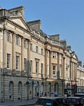 More images | |
| St James' Viaduct (Mln110705) | Lower Bristol Road | Railway Viaduct | Built in 1840 | ST7504264298 51°22′38″N 2°21′36″W / 51.377181°N 2.359974°W / 51.377181; -2.359974 (St James' Viaduct (Mln110705)) | 1395135 |  More images | |
| St James's Portico | Pierrepont Street | Open arcade with accommodation above | c. 1745 | ST7523164654 51°22′49″N 2°21′26″W / 51.38039°N 2.357283°W / 51.38039; -2.357283 (St James's Portico) | 1394396 |  | |
| Summerhill and attached Balustrades | Sion Hill Place | House | 1738 | ST7413566253 51°23′41″N 2°22′23″W / 51.394718°N 2.373148°W / 51.394718; -2.373148 (Summerhill and attached Balustrades) | 1394976 |  | |
| Sydney Gardens Footbridge (Mln110614) | Sydney Gardens | Footbridge | 1840-1841 | ST7580865270 51°23′09″N 2°20′57″W / 51.385954°N 2.349035°W / 51.385954; -2.349035 (Sydney Gardens Footbridge (Mln110614)) | 1395282 | More images | |
| The Garden House with attached Boundary Walls | Church Street | Boundary Wall | Mid 18th century | ST7598863870 51°22′24″N 2°20′47″W / 51.373374°N 2.346353°W / 51.373374; -2.346353 (The Garden House with attached Boundary Walls) | 1394120 | Upload Photo | |
| The Gymnasium to North of North Road | North Road, Prior Park | Fives Court | c. 1840 | ST7642762866 51°21′52″N 2°20′24″W / 51.364365°N 2.33998°W / 51.364365; -2.33998 (The Gymnasium to North of North Road) | 1394469 | Upload Photo | |
| The Huntsman Public House | Terrace Walk | House | 1748-50 | ST7517864698 51°22′51″N 2°21′29″W / 51.380784°N 2.358048°W / 51.380784; -2.358048 (The Huntsman Public House) | 1395323 |  More images | |
| The Priory | Prior Park | Estate Cottage | c. 1740 | ST7633163086 51°21′59″N 2°20′29″W / 51.366339°N 2.341373°W / 51.366339; -2.341373 (The Priory) | 1394465 |  More images | |
| Theatre Royal and former Garrick's Head public house | St John's Place | Theatre | C1720 | ST7483464845 51°22′56″N 2°21′47″W / 51.38209°N 2.363001°W / 51.38209; -2.363001 (Theatre Royal and former Garrick's Head public house) | 1394864 |  More images | |
| Thomas Warr Attwood Tomb in Church of All Saints Churchyard | Weston | Chest Tomb | 1775 | ST7311066346 51°23′44″N 2°23′16″W / 51.395507°N 2.387887°W / 51.395507; -2.387887 (Thomas Warr Attwood Tomb in Church of All Saints Churchyard) | 1394661 | Upload Photo | |
| Twerton Tunnel: East Entrance (adjoining Carr's Wood) | Lower Bristol Road | Railway Tunnel Portal | C1840 | ST7216064985 51°23′00″N 2°24′05″W / 51.383223°N 2.401434°W / 51.383223; -2.401434 (Twerton Tunnel: East Entrance (adjoining Carr's Wood)) | 1395139 | Upload Photo | |
| Twerton Tunnel: West Entrance (adjoining Carr's Wood) | Lower Bristol Road | Railway Tunnel Portal | C1840 | ST7212965008 51°23′00″N 2°24′07″W / 51.383429°N 2.401882°W / 51.383429; -2.401882 (Twerton Tunnel: West Entrance (adjoining Carr's Wood)) | 1395140 | Upload Photo | |
| Twerton Wood Tunnel East Portal | Lower Bristol Road | Railway Tunnel Portal | C1840 | ST7197065147 51°23′05″N 2°24′15″W / 51.384671°N 2.404177°W / 51.384671; -2.404177 (Twerton Wood Tunnel East Portal) | 1395142 | Upload Photo | |
| Twerton Wood Tunnel West Portal (Mln110915) | Lower Bristol Road | Railway Tunnel Portal | C1840 | ST7177865281 51°23′09″N 2°24′25″W / 51.385866°N 2.406947°W / 51.385866; -2.406947 (Twerton Wood Tunnel West Portal (Mln110915)) | 1395143 |  | |
| Two Watchmen's Boxes at Holburne Museum | Sydney Place, Bath | Watchman's Box | C1840 | ST7563265220 51°23′08″N 2°21′06″W / 51.385497°N 2.351561°W / 51.385497; -2.351561 (Two Watchmen's Boxes at Holburne Museum) | 1395306 |  | |
| Victoria Art Gallery and Library | Bridge Street | Art Gallery | 1897-1900 | ST7515064914 51°22′58″N 2°21′30″W / 51.382724°N 2.358466°W / 51.382724; -2.358466 (Victoria Art Gallery and Library) | 1394957 |  More images | |
| Victoria Bridge | Victoria Bridge Road | Suspension Bridge | 1836 | ST7412165008 51°23′01″N 2°22′24″W / 51.383523°N 2.373258°W / 51.383523; -2.373258 (Victoria Bridge) | 1395490 |  More images | |
| Victoria Column | Royal Victoria Park, Bath | Obelisk | 1837 | ST7420565274 51°23′09″N 2°22′19″W / 51.385919°N 2.372071°W / 51.385919; -2.372071 (Victoria Column) | 1394775 |  More images | |
| Victoria Gate | Royal Victoria Park, Bath | Gate | 1830 | ST7424065275 51°23′09″N 2°22′18″W / 51.38593°N 2.371568°W / 51.38593; -2.371568 (Victoria Gate) | 1394777 |  More images | |
| Watchman's Box | Norfolk Crescent | Watchman's Box | Circa 1810 | ST7436364960 51°22′59″N 2°22′11″W / 51.383103°N 2.369777°W / 51.383103; -2.369777 (Watchman's Box) | 1395748 |  More images | |
| 1-17, Raby Place | 1-17, Raby Place | Stepped Terrace | 1823-5 | ST7574964981 51°23′00″N 2°21′00″W / 51.383353°N 2.349863°W / 51.383353; -2.349863 (1-17, Raby Place) | 1394598 |  | |
| 15, Abbey Church Yard | Abbey Church Yard | House | Circa 1720 | ST7508664788 51°22′54″N 2°21′34″W / 51.381589°N 2.359376°W / 51.381589; -2.359376 (15, Abbey Church Yard) | 1394013 | Upload Photo | |
| 2 and 2A, Abbey Green | Abbey Green | House | Late C17 or early C18 | ST7513564676 51°22′50″N 2°21′31″W / 51.380584°N 2.358664°W / 51.380584; -2.358664 (2 and 2A, Abbey Green) | 1394026 | Upload Photo | |
| 3, Kingsmead Street | Kingsmead Street | Terrace | 1942 | ST7478064773 51°22′53″N 2°21′50″W / 51.38144°N 2.363772°W / 51.38144; -2.363772 (3, Kingsmead Street) | 1394052 | Upload Photo | |
| 8-17, Argyle Street | Argyle Street | Shop | Circa 1789 | ST7524664966 51°23′00″N 2°21′26″W / 51.383196°N 2.35709°W / 51.383196; -2.35709 (8-17, Argyle Street) | 1394149 |  | |
| 1-7, Barton Buildings | Barton Buildings | Terrace | 1768 | ST7486265088 51°23′03″N 2°21′45″W / 51.384276°N 2.362616°W / 51.384276; -2.362616 (1-7, Barton Buildings) | 1394169 | Upload Photo | |
| 10, Bathwick Hill | Bathwick Hill | Villa | Circa 1810 | ST7612764615 51°22′48″N 2°20′40″W / 51.380078°N 2.344407°W / 51.380078; -2.344407 (10, Bathwick Hill) | 1394193 | Upload Photo | |
| 1 and 2, Park Cottages | Park Cottages | House | 1831 | ST7422265328 51°23′11″N 2°22′19″W / 51.386405°N 2.37183°W / 51.386405; -2.37183 (1 and 2, Park Cottages) | 1394248 | Upload Photo | |
| 2, Pierrepont Place | Pierrepont Place | House | c. 1740 | ST7521164644 51°22′49″N 2°21′27″W / 51.380299°N 2.35757°W / 51.380299; -2.35757 (2, Pierrepont Place) | 1394380 | Upload Photo | |
| 7-13, Pierrepont Street | Pierrepont Street | House | 1740-1745 | ST7523064628 51°22′49″N 2°21′26″W / 51.380156°N 2.357296°W / 51.380156; -2.357296 (7-13, Pierrepont Street) | 1394385 | Upload Photo | |
| 2-6, Pierrepont Street | Pierrepont Street | House | 1740-5 | ST7523064628 51°22′49″N 2°21′26″W / 51.380156°N 2.357296°W / 51.380156; -2.357296 (2-6, Pierrepont Street) | 1394387 | Upload Photo | |
| 1-10, Portland Place | Portland Place | Apartment | 2010 | ST7473665653 51°23′22″N 2°21′52″W / 51.389351°N 2.364467°W / 51.389351; -2.364467 (1-10, Portland Place) | 1394403 | | |
| 7-11, Quiet Street | Quiet Street | Commercial Office | 1824-5 | ST7492264968 51°23′00″N 2°21′42″W / 51.3832°N 2.361746°W / 51.3832; -2.361746 (7-11, Quiet Street) | 1394594 |  More images | |
| 13, Crescent Lane | Crescent Lane | Garden Building | Mid 18th century | ST7453865486 51°23′16″N 2°22′02″W / 51.38784°N 2.367301°W / 51.38784; -2.367301 (13, Crescent Lane) | 1394971 | Upload Photo | |
| 19, Crescent Lane | Crescent Lane | House | C20 | ST7453865486 51°23′16″N 2°22′02″W / 51.38784°N 2.367301°W / 51.38784; -2.367301 (19, Crescent Lane) | 1394981 | Upload Photo | |
| 2-18, Brock Street | Brock Street | Terrace | 1763-1767 | ST7463565297 51°23′10″N 2°21′57″W / 51.386145°N 2.365893°W / 51.386145; -2.365893 (2-18, Brock Street) | 1395030 | Upload Photo | |
| 7, Upper Church Street | Upper Church Street | Stepped Terrace | 1770-1780 | ST7460365387 51°23′13″N 2°21′59″W / 51.386953°N 2.366359°W / 51.386953; -2.366359 (7, Upper Church Street) | 1395472 | Upload Photo | |
| 8, Upper Church Street | Upper Church Street | House | c. 1780 | ST7460365387 51°23′13″N 2°21′59″W / 51.386953°N 2.366359°W / 51.386953; -2.366359 (8, Upper Church Street) | 1395474 | Upload Photo | |
| 114 and 116, Walcot Street | Walcot Street | House | c. 1800 | ST7511065421 51°23′14″N 2°21′33″W / 51.387281°N 2.359076°W / 51.387281; -2.359076 (114 and 116, Walcot Street) | 1395581 | Upload Photo | |
| 8-18, Norfolk Crescent | Norfolk Crescent | Crescent | Circa 1800-1820 | ST7436364878 51°22′57″N 2°22′11″W / 51.382366°N 2.369771°W / 51.382366; -2.369771 (8-18, Norfolk Crescent) | 1395745 | | |
| 1-6, Widcombe Terrace | Widcombe Terrace | Terrace | c. 1805 | ST7579364028 51°22′29″N 2°20′57″W / 51.374786°N 2.349166°W / 51.374786; -2.349166 (1-6, Widcombe Terrace) | 1395776 | Upload Photo | |
| 4, North Parade | North Parade | House | 1740 | ST7521764679 51°22′50″N 2°21′27″W / 51.380614°N 2.357486°W / 51.380614; -2.357486 (4, North Parade) | 1395782 | Upload Photo | |
| 5, North Parade | North Parade | House | 1740 | ST7521764679 51°22′50″N 2°21′27″W / 51.380614°N 2.357486°W / 51.380614; -2.357486 (5, North Parade) | 1395783 | Upload Photo | |
| 6, North Parade | North Parade | Shop | 1740 | ST7521764679 51°22′50″N 2°21′27″W / 51.380614°N 2.357486°W / 51.380614; -2.357486 (6, North Parade) | 1395787 | Upload Photo | |
| 2, North Parade Passage | North Parade Passage | House | Circa 1716 | ST7514464693 51°22′51″N 2°21′31″W / 51.380737°N 2.358536°W / 51.380737; -2.358536 (2, North Parade Passage) | 1395824 | Upload Photo |
North East Somerset
Listed buildings in North East Somerset, outside Bath:
| Name | Location | Type | Completed [note 1] | Grid ref.[note 2] Geo-coordinates | Entry number [note 3] | Image | Ref. |
|---|---|---|---|---|---|---|---|
| Archway on street at the entrance to Park House | Keynsham | Augustinian Monastery | Mid 19th century | ST6551868912 51°25′05″N 2°29′50″W / 51.418166°N 2.497256°W / 51.418166; -2.497256 (Archway on street at the entrance to Park House) | 1384632 |  More images | [5] |
| Barn, coach house, stable, pigsties and attached outbuildings at Manor Farmhouse | Claverton | Barn | 15th century | ST7882264245 51°22′37″N 2°18′20″W / 51.376859°N 2.305662°W / 51.376859; -2.305662 (Barn, coach house, stable, pigsties and attached outbuildings at Manor Farmhouse) | 1214532 | Upload Photo | [6] |
| Barn, to north east of St Catherine's Court | St Catherine | Barn | 15th century | ST7776070285 51°25′52″N 2°19′17″W / 51.431126°N 2.321301°W / 51.431126; -2.321301 (Barn, to north east of St Catherine's Court) | 1277073 | Upload Photo | [7] |
| Barn to south west of Court Farmhouse | Langridge | Barn | 17th century | ST7394969516 51°25′27″N 2°22′34″W / 51.424049°N 2.376062°W / 51.424049; -2.376062 (Barn to south west of Court Farmhouse) | 1288592 | Upload Photo | [8] |
| Batheaston House | Batheaston | Detached House | 1712 | ST7786267462 51°24′21″N 2°19′11″W / 51.405748°N 2.319656°W / 51.405748; -2.319656 (Batheaston House) | 1320532 | Upload Photo | [9] |
| Bridge over River Chew | Stanton Drew | Bridge | 13-14th century | ST5967863446 51°22′07″N 2°34′50″W / 51.368634°N 2.580611°W / 51.368634; -2.580611 (Bridge over River Chew) | 1129649 |  More images | [10] |
| Chapel Farmhouse | Charlcombe | Farmhouse | 15th century | ST7264468710 51°25′00″N 2°23′41″W / 51.41674°N 2.394768°W / 51.41674; -2.394768 (Chapel Farmhouse) | 1288604 |  | [11] |
| Chew Court | Chew Magna | Country House | 14th or 15th century | ST5776463219 51°21′59″N 2°36′29″W / 51.366453°N 2.608077°W / 51.366453; -2.608077 (Chew Court) | 1320739 | 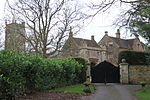 More images | [12] |
| Church of All Saints | Dunkerton | Parish Church | C14 | ST7112259298 51°19′55″N 2°24′57″W / 51.332037°N 2.415886°W / 51.332037; -2.415886 (Church of All Saints) | 1135797 |  More images | [13] |
| Church of All Saints | Farmborough | Parish Church | 15th century | ST6612460569 51°20′35″N 2°29′16″W / 51.343188°N 2.487743°W / 51.343188; -2.487743 (Church of All Saints) | 1136439 | 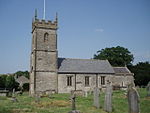 More images | [14] |
| Church of St Andrew | Chew Stoke | Parish Church | 15th century | ST5568261952 51°21′18″N 2°38′16″W / 51.354903°N 2.637823°W / 51.354903; -2.637823 (Church of St Andrew) | 1129632 |  More images | [15] |
| Church of St Augustine | Clutton | Parish Church | Late 12th century | ST6225858927 51°19′41″N 2°32′35″W / 51.32818°N 2.54307°W / 51.32818; -2.54307 (Church of St Augustine) | 1320766 |  More images | [16] |
| Church of St Catherine | St Catherine | Anglican Church | 1704 | ST7777170250 51°25′51″N 2°19′16″W / 51.430812°N 2.32114°W / 51.430812; -2.32114 (Church of St Catherine) | 1277121 |  More images | [17] |
| Church of St James | Southstoke | Anglican Church | c. 1850 | ST7465461234 51°20′59″N 2°21′55″W / 51.349614°N 2.365329°W / 51.349614; -2.365329 (Church of St James) | 1277046 |  More images | [18] |
| Church of St John the Baptist | Hinton Charterhouse | Parish Church | 12th century | ST7765558308 51°19′24″N 2°19′19″W / 51.323431°N 2.322054°W / 51.323431; -2.322054 (Church of St John the Baptist) | 1136127 |  More images | [19] |
| Church of St John the Baptist | Keynsham | Anglican Church | c. 1250 | ST6542668829 51°25′03″N 2°29′55″W / 51.417414°N 2.498571°W / 51.417414; -2.498571 (Church of St John the Baptist) | 1384628 |  More images | [20] |
| Church of St Laurence | East Harptree | Parish Church | Late 12th century | ST5654755974 51°18′04″N 2°37′29″W / 51.30122°N 2.624671°W / 51.30122; -2.624671 (Church of St Laurence) | 1312831 |  More images | [21] |
| Church of St Lawrence | Stanton Prior | Church | C12/C13 | ST6780362727 51°21′46″N 2°27′50″W / 51.36269°N 2.463835°W / 51.36269; -2.463835 (Church of St Lawrence) | 1129527 |  More images | [22] |
| Church of St Leonard | Chelwood | Parish Church | Norman | ST6356361860 51°21′17″N 2°31′29″W / 51.354637°N 2.524643°W / 51.354637; -2.524643 (Church of St Leonard) | 1320735 |  More images | [23] |
| Church of St Margaret | Queen Charlton | Anglican Church | 19th century | ST6342167010 51°24′03″N 2°31′38″W / 51.400933°N 2.527214°W / 51.400933; -2.527214 (Church of St Margaret) | 1115380 |  More images | [24] |
| Church of St Martin | North Stoke | Anglican Church | 12th century | ST7037469116 51°25′13″N 2°25′39″W / 51.420276°N 2.427444°W / 51.420276; -2.427444 (Church of St Martin) | 1215229 |  More images | [25] |
| Church of St Mary | Charlcombe | Anglican Church | 1857-61 | ST7485467346 51°24′16″N 2°21′46″W / 51.404579°N 2.362892°W / 51.404579; -2.362892 (Church of St Mary) | 1214255 |  More images | [26] |
| Church of St Mary | Compton Dando | Anglican Church | 1735 | ST6456664655 51°22′47″N 2°30′38″W / 51.379831°N 2.510519°W / 51.379831; -2.510519 (Church of St Mary) | 1320443 |  More images | [27] |
| Church of St Mary | Nempnett Thrubwell | Parish Church | 12th century | ST5328360400 51°20′27″N 2°40′19″W / 51.340756°N 2.672067°W / 51.340756; -2.672067 (Church of St Mary) | 1136164 |  More images | [28] |
| Church of St Mary | Stanton Drew | Parish Church | 15th century | ST5978163128 51°21′57″N 2°34′45″W / 51.365782°N 2.579095°W / 51.365782; -2.579095 (Church of St Mary) | 1136209 |  More images | [29] |
| Church of St Mary | Swainswick | Anglican Church | Mid-Late C19 | ST7565268417 51°24′51″N 2°21′05″W / 51.414243°N 2.351494°W / 51.414243; -2.351494 (Church of St Mary) | 1232679 |  More images | [30] |
| Church of St Mary | West Harptree | Parish Church | 12th century | ST5603056895 51°18′34″N 2°37′56″W / 51.309461°N 2.6322°W / 51.309461; -2.6322 (Church of St Mary) | 1312706 |  More images | [31] |
| Church of St Mary The Virgin | Timsbury | Anglican Church | 1826-32 | ST6672658603 51°19′32″N 2°28′44″W / 51.325547°N 2.478916°W / 51.325547; -2.478916 (Church of St Mary The Virgin) | 1129594 | 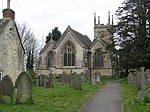 More images | [32] |
| Church of St Nicholas | Whitchurch | Parish Church | Late 12th century | ST6122367592 51°24′22″N 2°33′32″W / 51.406019°N 2.558872°W / 51.406019; -2.558872 (Church of St Nicholas) | 1136442 |  More images | [33] |
| Church of St Peter | Marksbury | Church | Late 12th century | ST6664962317 51°21′32″N 2°28′49″W / 51.358936°N 2.480371°W / 51.358936; -2.480371 (Church of St Peter) | 1320777 | 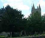 More images | [34] |
| Church of St Thomas à Becket | Pensford | Parish Church | Late C14 | ST6182563694 51°22′16″N 2°32′59″W / 51.371013°N 2.549798°W / 51.371013; -2.549798 (Church of St Thomas à Becket) | 1136393 |  More images | [35] |
| Church of The Holy Ghost | Midsomer Norton | Roman Catholic Church | 1900-1960 | ST6636754238 51°17′11″N 2°29′01″W / 51.286278°N 2.483656°W / 51.286278; -2.483656 (Church of The Holy Ghost) | 1115202 |  More images | [36] |
| Church of the Holy Trinity | Newton St Loe | Parish Church | 14th century | ST7011264878 51°22′56″N 2°25′51″W / 51.382157°N 2.430853°W / 51.382157; -2.430853 (Church of the Holy Trinity) | 1129501 |  More images | [37] |
| Church of The Holy Trinity | Paulton | Anglican Church | 1757 | ST6499256575 51°18′26″N 2°30′13″W / 51.307208°N 2.503601°W / 51.307208; -2.503601 (Church of The Holy Trinity) | 1320745 |  More images | [38] |
| Council Offices | Midsomer Norton | Grille | Mid-Late 18th century | ST6646954207 51°17′10″N 2°28′56″W / 51.286005°N 2.48219°W / 51.286005; -2.48219 (Council Offices) | 1115164 |  More images | [39] |
| Court Farmhouse | Charlcombe | Farmhouse | 1956 | ST7395669541 51°25′27″N 2°22′33″W / 51.424274°N 2.375963°W / 51.424274; -2.375963 (Court Farmhouse) | 1214263 | Upload Photo | [40] |
| Dovecot to Manor Farm, with Terrace Walling | Widcombe | Wall | early to Mid 18th century | ST7602963816 51°22′22″N 2°20′45″W / 51.37289°N 2.345761°W / 51.37289; -2.345761 (Dovecot to Manor Farm, with Terrace Walling) | 1394117 | Upload Photo | [41] |
| Dovecote | Wellow | Dovecote | 17th century | ST7404258364 51°19′26″N 2°22′26″W / 51.32378°N 2.373906°W / 51.32378; -2.373906 (Dovecote) | 1115370 |  More images | [42] |
| Dovecote, to South West of St Nicholas' Church | Kelston | Dovecote | Late C16/early 17th century | ST6984666889 51°24′01″N 2°26′05″W / 51.400224°N 2.434847°W / 51.400224; -2.434847 (Dovecote, to South West of St Nicholas' Church) | 1288368 |  More images | [43] |
| Eagle House and the Old Maltings | Bathford | House | Mid C18 | ST7888566755 51°23′58″N 2°18′18″W / 51.39943°N 2.304907°W / 51.39943; -2.304907 (Eagle House and the Old Maltings) | 1115272 | Upload Photo | [44] |
| Eagle House including balustrade 2m in front of south elevation | Batheaston | Apartment | 1956 | ST7795068347 51°24′49″N 2°19′06″W / 51.413708°N 2.318447°W / 51.413708; -2.318447 (Eagle House including balustrade 2m in front of south elevation) | 1115252 |  More images | [45] |
| Freshford Manor | Freshford | Manor House | early 18th century | ST7901160184 51°20′25″N 2°18′10″W / 51.340351°N 2.302706°W / 51.340351; -2.302706 (Freshford Manor) | 1115308 | Upload Photo | [46] |
| Garden building, 100 yards to south of Bathampton Lodge | Bathampton | Bath House | Late C18/early 19th century | ST7775166339 51°23′44″N 2°19′16″W / 51.395646°N 2.321181°W / 51.395646; -2.321181 (Garden building, 100 yards to south of Bathampton Lodge) | 1136996 | Upload Photo | [47] |
| Gournay Court | West Harptree | Country House | C1600 | ST5598756809 51°18′31″N 2°37′58″W / 51.308685°N 2.632806°W / 51.308685; -2.632806 (Gournay Court) | 1129581 |  More images | [48] |
| Hinton House | Hinton Charterhouse | Apartment | 1956 | ST7751658380 51°19′27″N 2°19′27″W / 51.324073°N 2.324053°W / 51.324073; -2.324053 (Hinton House) | 1136140 | Upload Photo | [49] |
| Iford Bridge | Freshford | Bridge | C1400 | ST8002158898 51°19′44″N 2°17′17″W / 51.328825°N 2.288134°W / 51.328825; -2.288134 (Iford Bridge) | 1115316 |  More images | [50] |
| Kelston Park and adjoining service wing and coach house and south retaining wall | Kelston | Country House | C1760S | ST7025766125 51°23′36″N 2°25′44″W / 51.393377°N 2.428875°W / 51.393377; -2.428875 (Kelston Park and adjoining service wing and coach house and south retaining wall) | 1215080 |  More images | [51] |
| Lyons Court Farmhouse | Whitchurch | Manor House | 15th century | ST6089167423 51°24′16″N 2°33′49″W / 51.404477°N 2.563626°W / 51.404477; -2.563626 (Lyons Court Farmhouse) | 1136453 | Upload Photo | [52] |
| Manor Farmhouse | Corston | Farmhouse | C1628 | ST6935865198 51°23′06″N 2°26′30″W / 51.384994°N 2.441715°W / 51.384994; -2.441715 (Manor Farmhouse) | 1312963 |  | [53] |
| Manor House | Queen Charlton | Manor House | 16th century | ST6338666990 51°24′03″N 2°31′40″W / 51.400751°N 2.527715°W / 51.400751; -2.527715 (Manor House) | 1115381 |  | [54] |
| Manor House | Wellow | House | 1634 | ST7403358310 51°19′24″N 2°22′27″W / 51.323294°N 2.374032°W / 51.323294; -2.374032 (Manor House) | 1158529 |  | [55] |
| Manorthorpe and Gardenthorpe | Freshford | Flats | 1983 | ST7895360124 51°20′23″N 2°18′13″W / 51.339809°N 2.303535°W / 51.339809; -2.303535 (Manorthorpe and Gardenthorpe) | 1158028 | Upload Photo | [56] |
| Mausoleum to Ralph Allen, in churchyard to south of St Mary's Church | Claverton | Mausoleum | 1764 | ST7878264115 51°22′32″N 2°18′22″W / 51.375688°N 2.306229°W / 51.375688; -2.306229 (Mausoleum to Ralph Allen, in churchyard to south of St Mary's Church) | 1214536 |  More images | [57] |
| No. 39 (Bailbrook House), London Road West | Bailbrook | House | 1790-1802 | ST7682266944 51°24′04″N 2°20′04″W / 51.401048°N 2.334574°W / 51.401048; -2.334574 (No. 39 (Bailbrook House), London Road West) | 1394890 | Upload Photo | [58] |
| Norman archway in garden wall to rear of number 83 (Vicarage) | Midsomer Norton | Church | Norman | ST6616654367 51°17′15″N 2°29′12″W / 51.287426°N 2.48655°W / 51.287426; -2.48655 (Norman archway in garden wall to rear of number 83 (Vicarage)) | 1115176 | Upload Photo | [59] |
| Old Brass Mill | Saltford | Brass Works | Ceased Operation 1924 | ST6871467002 51°24′04″N 2°27′04″W / 51.401179°N 2.451129°W / 51.401179; -2.451129 (Old Brass Mill) | 1384676 |  More images | [60] |
| Old School Room | Chew Magna | Church House | c. 1510 | ST5767363160 51°21′57″N 2°36′34″W / 51.365916°N 2.609377°W / 51.365916; -2.609377 (Old School Room) | 1135935 |  More images | [61] |
| Parish Church of St John The Baptist | Northend, Batheaston | Church | 12th century | ST7774867910 51°24′35″N 2°19′17″W / 51.409771°N 2.321324°W / 51.409771; -2.321324 (Parish Church of St John The Baptist) | 1320501 |  More images | [62] |
| Parish Church of St John The Baptist | Midsomer Norton | Parish Church | 15th century | ST6626054191 51°17′09″N 2°29′07″W / 51.285849°N 2.485185°W / 51.285849; -2.485185 (Parish Church of St John The Baptist) | 1320561 |  More images | [63] |
| Parish Church of St Nicholas | Bathampton | Parish Church | 13th century | ST7772266536 51°23′51″N 2°19′18″W / 51.397416°N 2.321611°W / 51.397416; -2.321611 (Parish Church of St Nicholas) | 1320551 |  More images | [64] |
| Church of St Peter | Freshford | Church | 15th century | ST7897160159 51°20′24″N 2°18′12″W / 51.340125°N 2.303279°W / 51.340125; -2.303279 (Church of St Peter) | 1115302 |  More images | [65] |
| Parish's House | Timsbury | House | Earlier | ST6733858714 51°19′36″N 2°28′13″W / 51.32658°N 2.470144°W / 51.32658; -2.470144 (Parish's House) | 1135909 |  More images | [66] |
| Pine House | Northend, Batheaston | House | 17th century | ST7779267918 51°24′35″N 2°19′14″W / 51.409845°N 2.320691°W / 51.409845; -2.320691 (Pine House) | 1137651 | Upload Photo | [67] |
| Rectory Farmhouse | Stanton Drew | Farmhouse | Mid 15th century | ST5972263287 51°22′02″N 2°34′48″W / 51.367207°N 2.579961°W / 51.367207; -2.579961 (Rectory Farmhouse) | 1129645 | Upload Photo | [68] |
| Retaining wall and central flight of steps, immediately to north east of St Catherine's Court | St Catherine | Steps | 17th century | ST7778970237 51°25′51″N 2°19′15″W / 51.430696°N 2.320881°W / 51.430696; -2.320881 (Retaining wall and central flight of steps, immediately to north east of St Catherine's Court) | 1277187 |  | [69] |
| Retaining walls and garden walls, enclosing west terrace and bowling green terrace, including central flight of steps to north west of St Catherine's Court | St Catherine | Garden Wall | Late 17th century | ST7774570190 51°25′49″N 2°19′17″W / 51.430272°N 2.321511°W / 51.430272; -2.321511 (Retaining walls and garden walls, enclosing west terrace and bowling green terrace, including central flight of steps to north west of St Catherine's Court) | 1232373 | Upload Photo | [70] |
| Rock House | Bathford | House | early-Mid 18th century | ST7909766893 51°24′02″N 2°18′07″W / 51.400679°N 2.301868°W / 51.400679; -2.301868 (Rock House) | 1138297 | Upload Photo | [71] |
| Saltford Manor House | Saltford | Manor House | c. 1160 | ST6853267477 51°24′20″N 2°27′14″W / 51.40544°N 2.453787°W / 51.40544; -2.453787 (Saltford Manor House) | 1384672 |  More images | [72] |
| Sham Castle | Bathampton | Prospect Tower | 1762 | ST7660764864 51°22′56″N 2°20′15″W / 51.382337°N 2.337527°W / 51.382337; -2.337527 (Sham Castle) | 1312449 |  More images | [73] |
| Stable Block and Coach House | Bath Spa University, Newton St Loe | Coach House | 1984 | ST6931663953 51°22′26″N 2°26′32″W / 51.373797°N 2.44221°W / 51.373797; -2.44221 (Stable Block and Coach House) | 1129477 | Upload Photo | [74] |
| Sutton Court | Stowey | Country House | 14th century | ST5968260451 51°20′30″N 2°34′49″W / 51.341706°N 2.580213°W / 51.341706; -2.580213 (Sutton Court) | 1129576 |  More images | [75] |
| The Beeches | Chew Magna | House | 1762 | ST5736863139 51°21′57″N 2°36′50″W / 51.365704°N 2.613755°W / 51.365704; -2.613755 (The Beeches) | 1129620 |  More images | [76] |
| The Court | Stanton Drew | House | 1753 | ST5977763314 51°22′03″N 2°34′45″W / 51.367454°N 2.579174°W / 51.367454; -2.579174 (The Court) | 1136188 |  More images | [77] |
| The Grey House | St Catherine | Detached House | Mid-Late 17th century | ST7619670984 51°26′14″N 2°20′38″W / 51.437348°N 2.343845°W / 51.437348; -2.343845 (The Grey House) | 1277076 | Upload Photo | [78] |
| The Manor House (The Sacred Heart Convent High School) | Chew Magna | House | Late C15-early 16th century | ST5708263274 51°22′01″N 2°37′04″W / 51.366897°N 2.617879°W / 51.366897; -2.617879 (The Manor House (The Sacred Heart Convent High School)) | 1129609 | Upload Photo | [79] |
| The Old Parsonage | Farrington Gurney | House | Late 17th century | ST6294555581 51°17′53″N 2°31′58″W / 51.29814°N 2.532862°W / 51.29814; -2.532862 (The Old Parsonage) | 1136471 |  More images | [80] |
| The Priory | Midsomer Norton | House | early-Mid C17 | ST6622854271 51°17′12″N 2°29′08″W / 51.286566°N 2.485652°W / 51.286566; -2.485652 (The Priory) | 1115160 |  More images | [81] |
| The Rectory | Chew Stoke | Vicarage | 1529 | ST5581761904 51°21′16″N 2°38′09″W / 51.354482°N 2.635878°W / 51.354482; -2.635878 (The Rectory) | 1320747 |  More images | [82] |
| The Stables, The Old Chapel and the Remains of The Chapel, Walls enclosing Stableyard, Coach House and Greenhouse to Midford Castle | Southstoke | House | 1956 | ST7595461374 51°21′03″N 2°20′48″W / 51.350929°N 2.346672°W / 51.350929; -2.346672 (The Stables, The Old Chapel and the Remains of The Chapel, Walls enclosing Stableyard, Coach House and Greenhouse to Midford Castle) | 1277080 | Upload Photo | [83] |
| Tithe Barn and adjoining Stable and Dovecote and Horse Engine House | Southstoke | Dovecote | Late C16-early 17th century | ST7460561224 51°20′58″N 2°21′58″W / 51.349522°N 2.366032°W / 51.349522; -2.366032 (Tithe Barn and adjoining Stable and Dovecote and Horse Engine House) | 1277026 |  | [84] |
| Tithe Barn attached to south end of rectory farmhouse | Englishcombe | Tithe Barn | 15th century or early 16th century | ST7164762800 51°21′49″N 2°24′31″W / 51.363552°N 2.408631°W / 51.363552; -2.408631 (Tithe Barn attached to south end of rectory farmhouse) | 1136116 |  More images | [85] |
| Walls enclosing a Garden between The Gatehouse and Stables | Newton St Loe | Wall | 18th century | ST6934863983 51°22′27″N 2°26′30″W / 51.374069°N 2.441753°W / 51.374069; -2.441753 (Walls enclosing a Garden between The Gatehouse and Stables) | 1365665 | Upload Photo | [86] |
| Walls, Retaining Walls, Gates, Gatepiers and Central Flight of Steps, enclosing Garden and Terraces, to South of Manor Farmhouse | Claverton | Gate | early 17th century | ST7881964171 51°22′34″N 2°18′21″W / 51.376193°N 2.305701°W / 51.376193; -2.305701 (Walls, Retaining Walls, Gates, Gatepiers and Central Flight of Steps, enclosing Garden and Terraces, to South of Manor Farmhouse) | 1214533 | Upload Photo | [87] |
| Warleigh Manor School | Bathford | Country House | 1814-15 | ST7913864818 51°22′55″N 2°18′04″W / 51.382023°N 2.301156°W / 51.382023; -2.301156 (Warleigh Manor School) | 1157904 |  More images | [88] |
| Watercress Cottage | Combe Hay | House | 1624 | ST7339059939 51°20′16″N 2°23′00″W / 51.337912°N 2.383381°W / 51.337912; -2.383381 (Watercress Cottage) | 1115367 | Upload Photo | [89] |
| Wellow House, including Boundary Wall, Gate and Two Pairs of Gatepiers to road | Wellow | House | 17th century | ST7387158213 51°19′21″N 2°22′35″W / 51.322415°N 2.376349°W / 51.322415; -2.376349 (Wellow House, including Boundary Wall, Gate and Two Pairs of Gatepiers to road) | 1158552 | Upload Photo | [90] |
| Welton Manor House | Midsomer Norton | Manor House | 1620 | ST6698855053 51°17′37″N 2°28′29″W / 51.293643°N 2.474827°W / 51.293643; -2.474827 (Welton Manor House) | 1136842 | Upload Photo | [91] |
| Whitehaven | Bathford | Country House | 1748 | ST7906866940 51°24′04″N 2°18′08″W / 51.4011°N 2.302288°W / 51.4011; -2.302288 (Whitehaven) | 1137983 | Upload Photo | [92] |
| 108 and 110, Northend | Batheaston | House | Mid-Late C17 | ST7794368294 51°24′48″N 2°19′07″W / 51.413232°N 2.318544°W / 51.413232; -2.318544 (108 and 110, Northend) | 1115244 | Upload Photo | [93] |
| 15, The Batch | Batheaston | House | early C18 | ST7778067476 51°24′21″N 2°19′15″W / 51.40587°N 2.320836°W / 51.40587; -2.320836 (15, The Batch) | 1312374 | Upload Photo | [94] |
| 37, Priory Close | Midsomer Norton | Bungalow | Modern | ST6614854302 51°17′13″N 2°29′12″W / 51.28684°N 2.486802°W / 51.28684; -2.486802 (37, Priory Close) | 1115178 | Upload Photo | [95] |
See also
Notes
- ^ a b The date given is the date used by Historic England as significant for the initial building or that of an important part in the structure's description.
- ^ a b Sometimes known as OSGB36, the grid reference is based on the British national grid reference system used by the Ordnance Survey.
- ^ a b The "List Entry Number" is a unique number assigned to each listed building and scheduled monument by Historic England.
References
- ^ "The Avon (Structural Change) Order 1995". Her Majesty's Stationery Office (HMSO). Archived from the original on 30 January 2008. Retrieved 9 December 2007.
- ^ a b c "About the area". Bath and North East Somerset Council. Archived from the original on 4 November 2007. Retrieved 30 December 2007.
- ^ "Listed Buildings". Historic England. Retrieved 23 August 2017.
- ^ "Planning (Listed Buildings and Conservation Areas) Act 1990 (c. 9)". Ministry of Justice. Archived from the original on 18 April 2010. Retrieved 17 December 2007.
- ^ Historic England. "Archway on Street at The Entrance to Park House (1384632)". National Heritage List for England. Retrieved 3 April 2015.
- ^ Historic England. "Barn, coach-house, stables, pig-sties and outbuilding (1214532)". National Heritage List for England. Retrieved 3 April 2015.
- ^ Historic England. "Barn, to north east of St Catherine's Court (1277073)". National Heritage List for England. Retrieved 6 July 2015.
- ^ Historic England. "Barn to south west of Court Farmhouse (1288592)". National Heritage List for England. Retrieved 3 April 2015.
- ^ Historic England. "Batheaston House (1320532)". National Heritage List for England. Retrieved 3 April 2015.
- ^ Historic England. "Bridge over River Chew (1129649)". National Heritage List for England. Retrieved 3 April 2015.
- ^ Historic England. "Chapel Farmhouse (1288604)". National Heritage List for England. Retrieved 3 April 2015.
- ^ Historic England. "Chew Court (1320739)". National Heritage List for England. Retrieved 3 April 2015.
- ^ Historic England. "Church of All Saints (1135797)". National Heritage List for England. Retrieved 3 April 2015.
- ^ Historic England. "Church of All Saints (1136439)". National Heritage List for England. Retrieved 3 April 2015.
- ^ Historic England. "Church of St Andrew (1129632)". National Heritage List for England. Retrieved 3 April 2015.
- ^ Historic England. "Church of St Augustine (1320766)". National Heritage List for England. Retrieved 3 April 2015.
- ^ Historic England. "Church of St Catherine (1277121)". National Heritage List for England. Retrieved 3 April 2015.
- ^ Historic England. "Church of St James (1277046)". National Heritage List for England. Retrieved 3 April 2015.
- ^ Historic England. "Church of St John The Baptist (1136127)". National Heritage List for England. Retrieved 3 April 2015.
- ^ Historic England. "Church of St John the Baptist (1384628)". National Heritage List for England. Retrieved 3 April 2015.
- ^ Historic England. "Church of St Laurence (1312831)". National Heritage List for England. Retrieved 3 April 2015.
- ^ Historic England. "Church of St Lawrence (1129527)". National Heritage List for England. Retrieved 3 April 2015.
- ^ Historic England. "Church of St Leonard (1320735)". National Heritage List for England. Retrieved 3 April 2015.
- ^ Historic England. "Church of St Margaret (1115380)". National Heritage List for England. Retrieved 3 April 2015.
- ^ Historic England. "Church of St Martin (1215229)". National Heritage List for England. Retrieved 3 April 2015.
- ^ Historic England. "Church of St Mary (1214255)". National Heritage List for England. Retrieved 3 April 2015.
- ^ Historic England. "Church of St Mary (1320443)". National Heritage List for England. Retrieved 3 April 2015.
- ^ Historic England. "Church of St Mary (1136164)". National Heritage List for England. Retrieved 3 April 2015.
- ^ Historic England. "Church of St Mary (1136209)". National Heritage List for England. Retrieved 3 April 2015.
- ^ Historic England. "Church of St Mary (1232679)". National Heritage List for England. Retrieved 3 April 2015.
- ^ Historic England. "Church of St Mary (1312706)". National Heritage List for England. Retrieved 3 April 2015.
- ^ Historic England. "Church of St Mary The Virgin (1129594)". National Heritage List for England. Retrieved 3 April 2015.
- ^ Historic England. "Church of St Nicholas (1136442)". National Heritage List for England. Retrieved 3 April 2015.
- ^ Historic England. "Church of St Peter (1320777)". National Heritage List for England. Retrieved 3 April 2015.
- ^ Historic England. "Church of St Thomas a Becket (1136393)". National Heritage List for England. Retrieved 3 April 2015.
- ^ Historic England. "Church of The Holy Ghost (1115202)". National Heritage List for England. Retrieved 3 April 2015.
- ^ Historic England. "Church of the Holy Trinity (1129501)". National Heritage List for England. Retrieved 3 April 2015.
- ^ Historic England. "Church of the Holy Trinity (1320745)". National Heritage List for England. Retrieved 3 April 2015.
- ^ Historic England. "Council Offices (1115164)". National Heritage List for England. Retrieved 3 April 2015.
- ^ Historic England. "Court Farmhouse (1214263)". National Heritage List for England. Retrieved 3 April 2015.
- ^ Historic England. "Dovecot to Manor Farm, with Terrace Walling (1394117)". National Heritage List for England. Retrieved 3 April 2015.
- ^ "Dovecote, 100 Yards to Rear of Manor House". National heritage list for England. English Heritage. Retrieved 14 July 2013.
- ^ Historic England. "Dovecote, to South West of St Nicholas' Church (1288368)". National Heritage List for England. Retrieved 6 July 2015.
- ^ Historic England. "Eagle House and the Old Maltings (1115272)". National Heritage List for England. Retrieved 3 April 2015.
- ^ "Eagle House including balustrade 2 yards in front of south elevation". National heritage list for England. English Heritage. Retrieved 28 August 2013.
- ^ Historic England. "Freshford Manor (1115308)". National Heritage List for England. Retrieved 3 April 2015.
- ^ "Garden building, 100 yards to south of Bathampton Lodge". National heritage list for England. English Heritage. Retrieved 28 August 2013.
- ^ Historic England. "Gournay Court (1129581)". National Heritage List for England. Retrieved 3 April 2015.
- ^ Historic England. "Hinton House (1136140)". National Heritage List for England. Retrieved 3 April 2015.
- ^ Historic England. "Iford Bridge (1115316)". National Heritage List for England. Retrieved 3 April 2015.
- ^ Historic England. "Kelston Park and adjoining service wing and coach house and south retaining wall (1215080)". National Heritage List for England. Retrieved 3 April 2015.
- ^ Historic England. "Lyons Court Farmhouse (1136453)". National Heritage List for England. Retrieved 3 April 2015.
- ^ Historic England. "Manor Farmhouse (1312963)". National Heritage List for England. Retrieved 3 April 2015.
- ^ Historic England. "Manor House (1115381)". National Heritage List for England. Retrieved 3 April 2015.
- ^ Historic England. "Manor House (1158529)". National Heritage List for England. Retrieved 3 April 2015.
- ^ Historic England. "Manorthorpe and Gardenthorpe (1158028)". National Heritage List for England. Retrieved 3 April 2015.
- ^ Historic England. "Mausoleum to Ralph Allen, in churchyard to south of St Mary's Church (1214536)". National Heritage List for England. Retrieved 6 July 2015.
- ^ Historic England. "No. 39 Bailbrook House (1394890)". National Heritage List for England. Retrieved 3 April 2015.
- ^ Historic England. "Norman archway in garden wall to rear of number 83 (Vicarage) (1115176)". National Heritage List for England. Retrieved 3 April 2015.
- ^ Historic England. "Old Brass Mill (1384676)". National Heritage List for England. Retrieved 3 April 2015.
- ^ Historic England. "Old School Room (1135935)". National Heritage List for England. Retrieved 3 April 2015.
- ^ Historic England. "Parish Church of St John The Baptist (1320501)". National Heritage List for England. Retrieved 3 April 2015.
- ^ Historic England. "Parish Church of St John The Baptist (1320561)". National Heritage List for England. Retrieved 3 April 2015.
- ^ Historic England. "Parish Church of St Nicholas (1320551)". National Heritage List for England. Retrieved 3 April 2015.
- ^ Historic England. "Church of St Peter (1115302)". National Heritage List for England. Retrieved 3 April 2015.
- ^ Historic England. "Parish's House (1135909)". National Heritage List for England. Retrieved 6 July 2015.
- ^ Historic England. "Pine House (1137651)". National Heritage List for England. Retrieved 3 April 2015.
- ^ Historic England. "Rectory Farmhouse (1129645)". National Heritage List for England. Retrieved 3 April 2015.
- ^ Historic England. "Retaining wall and central flight of steps, immediately to north east of St Catherine's Court (1277187)". National Heritage List for England. Retrieved 6 July 2015.
- ^ Historic England. "Retaining walls and garden walls, enclosing west terrace and bowling green terrace, including central flight of steps to north west of St Catherine's Court (1232373)". National Heritage List for England. Retrieved 6 July 2015.
- ^ Historic England. "Rock House (1138297)". National Heritage List for England. Retrieved 3 April 2015.
- ^ Historic England. "Saltford Manor House (1384672)". National Heritage List for England. Retrieved 3 April 2015.
- ^ Historic England. "Sham Castle (1312449)". National Heritage List for England. Retrieved 3 April 2015.
- ^ Historic England. "Stable Block and Coach House (1129477)". National Heritage List for England. Retrieved 3 April 2015.
- ^ Historic England. "Sutton Court (1129576)". National Heritage List for England. Retrieved 3 April 2015.
- ^ Historic England. "The Beeches (1129620)". National Heritage List for England. Retrieved 3 April 2015.
- ^ Historic England. "The Court (1136188)". National Heritage List for England. Retrieved 3 April 2015.
- ^ Historic England. "The Grey House (1277076)". National Heritage List for England. Retrieved 3 April 2015.
- ^ Historic England. "The Manor House (The Sacred Heart Convent High School) (1129609)". National Heritage List for England. Retrieved 3 April 2015.
- ^ Historic England. "The Old Parsonage (1136471)". National Heritage List for England. Retrieved 3 April 2015.
- ^ Historic England. "The Priory (1115160)". National Heritage List for England. Retrieved 3 April 2015.
- ^ Historic England. "The Rectory (1320747)". National Heritage List for England. Retrieved 3 April 2015.
- ^ Historic England. "The Stables, The Old Chapel and the Remains of The Chapel, Walls enclosing Stableyard, Coach House and Greenhouse to Midford Castle (1277080)". National Heritage List for England. Retrieved 3 April 2015.
- ^ Historic England. "Tithe Barn and Adjoining Stable and Dovecote and Horse Engine House (1277026)". National Heritage List for England. Retrieved 3 April 2015.
- ^ Historic England. "Tithe Barn attached to south end of rectory farmhouse (1136116)". National Heritage List for England. Retrieved 3 April 2015.
- ^ Historic England. "Walls enclosing a Garden between The Gatehouse and Stables (1365665)". National Heritage List for England. Retrieved 3 April 2015.
- ^ Historic England. "Walls, Retaining Walls, Gates, Gatepiers and Central Flight of Steps, enclosing Garden and Terraces, to South of Manor Farmhouse (1214533)". National Heritage List for England. Retrieved 3 April 2015.
- ^ Historic England. "Warleigh Manor School (1157904)". National Heritage List for England. Retrieved 3 April 2015.
- ^ Historic England. "Watercress Cottage (1115367)". National Heritage List for England. Retrieved 3 April 2015.
- ^ Historic England. "Wellow House, including Boundary Wall, Gate and Two Pairs of Gatepiers to road (1158552)". National Heritage List for England. Retrieved 3 April 2015.
- ^ Historic England. "Welton Manor House (1136842)". National Heritage List for England. Retrieved 3 April 2015.
- ^ Historic England. "Whitehaven (1137983)". National Heritage List for England. Retrieved 3 April 2015.
- ^ Historic England. "108 and 110, Northend (1115244)". National Heritage List for England. Retrieved 3 April 2015.
- ^ Historic England. "15, The Batch (1312374)". National Heritage List for England. Retrieved 3 April 2015.
- ^ Historic England. "37, Priory Close (1115178)". National Heritage List for England. Retrieved 3 April 2015.
External links
![]() Media related to Grade II* listed buildings in Bath and North East Somerset District at Wikimedia Commons
Media related to Grade II* listed buildings in Bath and North East Somerset District at Wikimedia Commons
- v
- t
- e
- Bath and North East Somerset
- Mendip
- North Somerset
- Sedgemoor
- South Somerset
- Taunton Deane
- West Somerset


