Městec Králové
Town in Central Bohemian, Czech Republic

Flag
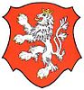
Coat of arms
 Czech Republic
 (2024-01-01)[1]
289 03
Městec Králové (Czech pronunciation: [ˈmɲɛstɛts ˈkraːlovɛː]; German: Königstädtel) is a town in Nymburk District in the Central Bohemian Region of the Czech Republic. It has about 2,900 inhabitants.
Administrative parts
The villages of Nový and Vinice are administrative parts of Městec Králové.
Etymology
The name means "small town of the King". The original name of the town was Královo Městce, later it changed to Králův Městec and then to the current form.[2]
Geography
Městec Králové is located about 18 kilometres (11 mi) east of Nymburk and 54 km (34 mi) east of Prague. It lies in the Central Elbe Table. The highest point is a place called Kostelíček with an altitude of 241 m (791 ft). The stream Štítarský potok flows through the municipal territory.
History
Městec Králové was established as a walled town on the road from Hradec Králové to Prague in the 13th century.[3]
According to legends, Queen Kunigunde, the wife of King Wenceslaus I of Bohemia, was returning from Červený Hradec (today Hradec Králové) to Prague and abruptly gave birth to Ottokar II of Bohemia, the most powerful king of the Přemyslid Dynasty, in Městec Králové. Ottokar II rewarded his assumed birthplace by a lion on its coats of arms and some privileges reserved for royal towns.[3]
The town was almost destroyed during the Thirty Years' War and by large fires in 1680, 1746, 1776 and 1792.[3]
Demographics
|
|
| ||||||||||||||||||||||||||||||||||||||||||||||||||||||
| Source: Censuses[4][5] | ||||||||||||||||||||||||||||||||||||||||||||||||||||||||
Transport
Městec Králové is the terminus and start of a railway line from/to Chlumec nad Cidlinou.[6]
Sights

The main landmark of Městec Králové is the Church of Saint Margaret. It was built in 1793, after a fire in 1792 burned down the old building. In the 19th century, the church was repaired and the Romanesque tower was added.[3]
Among the most valuable buildings is the town hall, built in 1799.[3]
Notable people
- Ottokar II of Bohemia (1233–1278), King of Bohemia
- František Xaver Pokorný (1729–1794), composer and violinist
- Karel Kněžourek (1857–1920), naturalist
- Otakar Zich (1879–1934), composer and aesthetician
- Karel Schulz (1899–1943), writer
- Ivan Hašek (born 1963), football player and manager
- Aleš Hruška (born 1985), footballer
- Bořek Dočkal (born 1988), footballer
References
- ^ "Population of Municipalities – 1 January 2024". Czech Statistical Office. 2024-05-17.
- ^ Profous, Antonín (1951). Místní jména v Čechách III: M–Ř (in Czech). p. 54.
- ^ a b c d e "Historie města" (in Czech). Město Městec Králové. Retrieved 2021-07-07.
- ^ "Historický lexikon obcí České republiky 1869–2011 – Okres Nymburk" (in Czech). Czech Statistical Office. 2015-12-21. pp. 7–8.
- ^ "Population Census 2021: Population by sex". Public Database. Czech Statistical Office. 2021-03-27.
- ^ "Detail stanice Městec Králové" (in Czech). České dráhy. Retrieved 2024-06-24.
External links
Wikimedia Commons has media related to Městec Králové.
- Official website
- v
- t
- e
Towns, market towns and villages of Nymburk District
- Běrunice
- Bobnice
- Bříství
- Budiměřice
- Chleby
- Choťánky
- Chotěšice
- Chrást
- Chroustov
- Čilec
- Činěves
- Dlouhopolsko
- Dobšice
- Dvory
- Dymokury
- Hořany
- Hořátev
- Hradčany
- Hradištko
- Hrubý Jeseník
- Jíkev
- Jiřice
- Jizbice
- Kamenné Zboží
- Kněžice
- Kněžičky
- Kolaje
- Košík
- Kostelní Lhota
- Kostomlátky
- Kostomlaty nad Labem
- Kounice
- Kouty
- Kovanice
- Krchleby
- Křečkov
- Křinec
- Libice nad Cidlinou
- Loučeň
- Lysá nad Labem
- Mcely
- Městec Králové
- Milčice
- Milovice
- Netřebice
- Nový Dvůr
- Nymburk
- Odřepsy
- Okřínek
- Opočnice
- Opolany
- Oseček
- Oskořínek
- Ostrá
- Pátek
- Písková Lhota
- Písty
- Poděbrady
- Podmoky
- Přerov nad Labem
- Rožďalovice
- Sadská
- Sány
- Seletice
- Semice
- Senice
- Sloveč
- Sokoleč
- Stará Lysá
- Starý Vestec
- Straky
- Stratov
- Třebestovice
- Úmyslovice
- Velenice
- Velenka
- Vestec
- Vlkov pod Oškobrhem
- Vrbice
- Vrbová Lhota
- Všechlapy
- Vykáň
- Záhornice
- Zbožíčko
- Žitovlice
- Zvěřínek
| Authority control databases: National |
|
|---|


